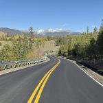
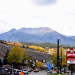
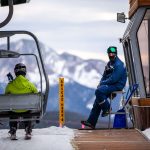
Colorado skiers may need to wait longer for snow this winter
Climatologists say snowfall could see a later start this ski season, thanks to warmer Pacific waters and a growing La Niña phase.

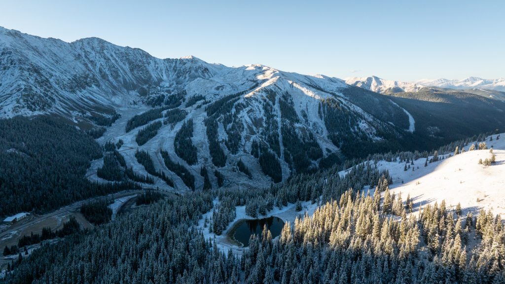
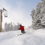
Lucas Herbert/Arapahoe Basin
Colorado’s ski season may see a later start this winter as unusually warm Pacific Ocean temperatures and a budding La Niña are forecast to delay snowfall across much of the Rockies.
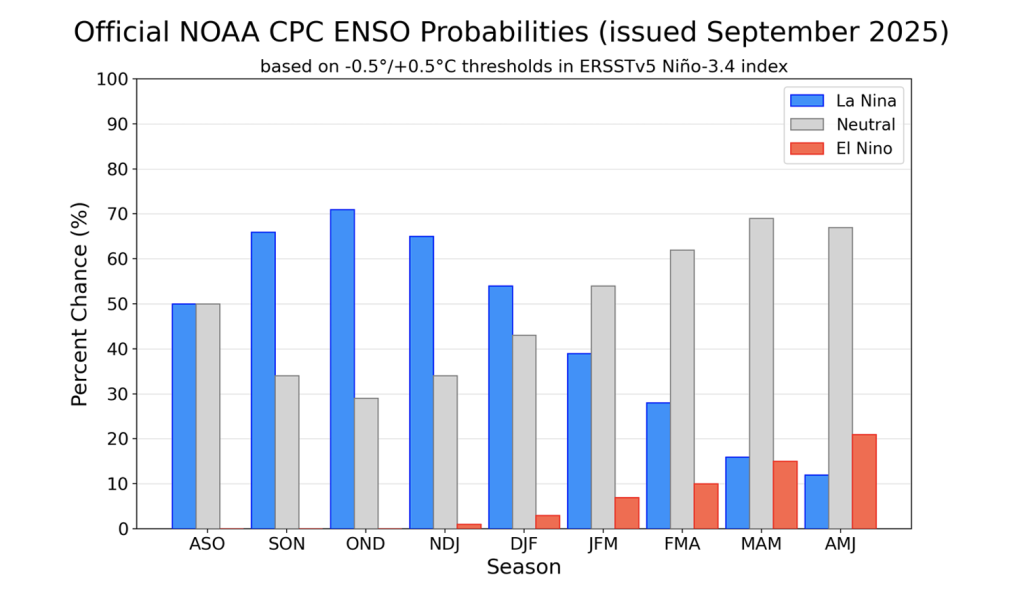
The consensus thus far is that climate patterns are trending toward a weak La Niña phase, which signals a shift towards drier-than-average conditions. According to meteorologists at OpenSnow, the latest sea surface temperature anomaly in part of the Eastern Equatorial Pacific is -0.4ºC, just shy of the -0.5ºC threshold needed to reach La Niña.
This only shows a lean toward La Niña because the threshold “must be met for five consecutive 3-month overlapping periods” for it to officially be classified as a La Niña. However, the National Oceanic and Atmospheric Administration’s latest outlook shows a 71% chance of La Niña from October to December, with neutral conditions returning by spring.
When looking at the incoming winter ski season, sea surface temperatures are a large indicator of whether the onset of winter weather will come earlier or later in the season.
The North Pacific in particular is currently seeing warmer temperatures than what is considered normal for this time of year, which is changing circulation patterns in the Northern Hemisphere. This anomalous ocean warming was coined the Pacific “Blob” by Washington State Climatologist Nick Bond and is largely why forecasters have switched from predictions of neutral conditions to La Niña.
“Globally, these temperatures are really warm right now,” said Kyle Heyblom, an Earth system scientist with AI-driven forecasting company Planette. “This is largely driven by our climate change signal, but we are seeing some additional patches of additional warming on top of that.”
When it comes to the Central to Southern Rockies region covering most of Colorado, Heyblom said November precipitation — usually considered the start of the ski season — could see a later start, with the chances of rain increasing near the Northwest U.S. toward the Canadian Rockies and decreasing the farther south you go.
“Those weather patterns being forced by that warming in the Pacific are also favoring warmer temperatures over more of the continental U.S., so moving more inland,” Heyblom said during a Tuesday forecasting webinar. “Those warmer temperatures are going to favor a delayed onset to the season. … It is quite possible that the ski season is going to have to push a little further into the year just because we may not see cold enough temperatures to make snow.”
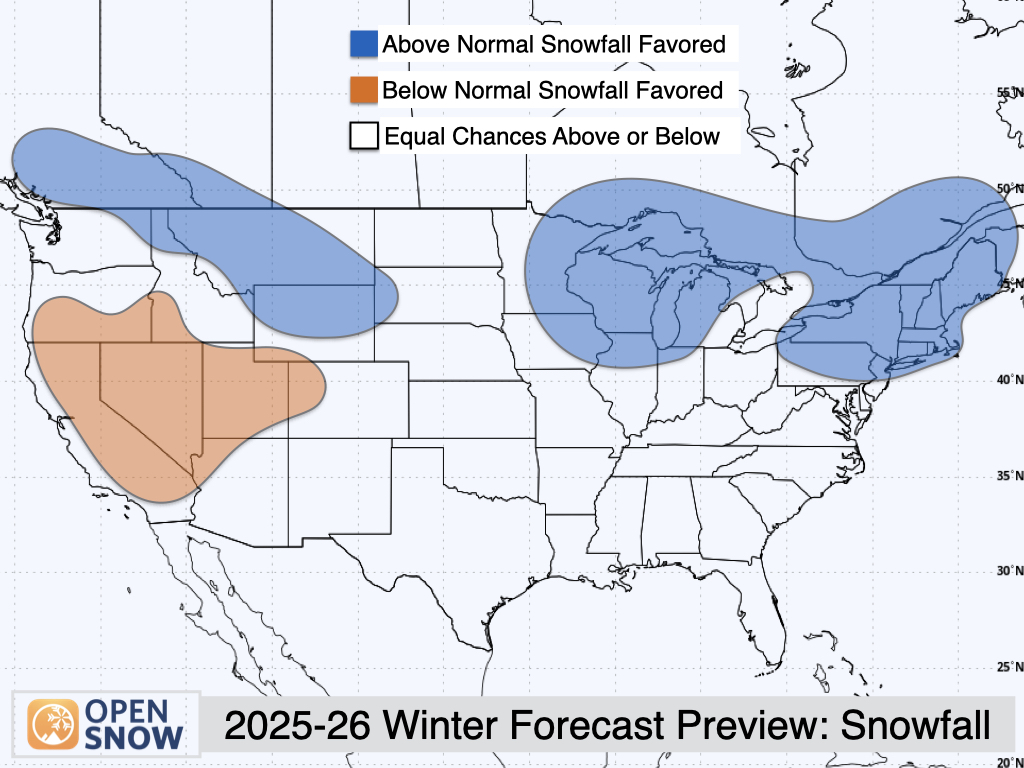
OpenSnow’s winter forecast predicted similar snowfall trends, with higher odds of above-normal snowfall projected for the Northern U.S. Rockies, Upper Midwest and the Northeast, while the Western region covering Colorado’s Western Slope sees higher odds of below-normal snowfall. The western region is also poised to see above-normal temperatures this winter.
That being said, many of the ski areas in the Southern Rockies region are higher in elevation, meaning snowfall could reach levels more conducive to skiing come December and January, Heyblom said.
“If you want to get that early ski season in, we highly recommend turning your eyes toward the lower (British Columbia) coast, the Northern Rockies and the Pacific Northwest,” Heyblom said. “We really are seeing the setup for the best conditions in that area. If you’re heading toward the lower western states … it might be a good idea to delay that trip to December, January, maybe into February.”
Things could change depending on whether or not “The Blob’s” abnormally high temperatures are consistent, which is what causes fewer storms along the West Coast of the U.S. According to OpenSnow, there have been past years in which a strong Blob emerged late in the summer only to fade heading into the winter.
The European Seasonal Model suggests a more encouraging forecast, which projects that the extreme warm anomalies will gradually weaken over the course of the fall and winter, lessening their impacts on the west’s weather patterns.
“With those particular sea surface temperatures that we’re seeing, which are across the board much warmer than usual conditions over the ocean, combined with that high pressure center that’s sitting over North America, we really think that, in some of these locations particularly, it does not look like it’s going to favor good early-season conditions,” said Hansi Singh, CEO and co-founder of Planette.


Support Local Journalism
Support Local Journalism
As a Summit Daily News reader, you make our work possible.
Summit Daily is embarking on a multiyear project to digitize its archives going back to 1989 and make them available to the public in partnership with the Colorado Historic Newspapers Collection. The full project is expected to cost about $165,000. All donations made in 2023 will go directly toward this project.
Every contribution, no matter the size, will make a difference.