Persistent rain washes away the most extreme drought on Colorado’s Western Slope, but concerns remain
La Nina prepares to make a brief appearance in Colorado this fall before winter forecasts turn even more unpredictable than usual

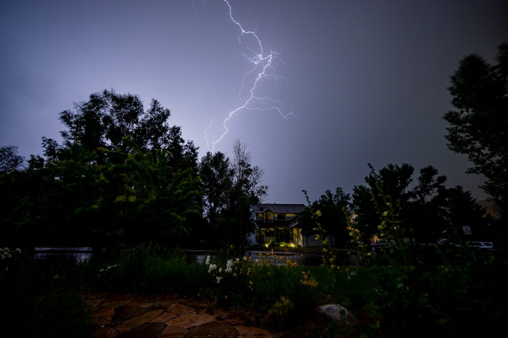
Ben Roof/Vail Daily archive
Following an extremely warm, dry summer on the Western Slope, recent rainfall is beginning to chip away at the worst of Colorado’s drought conditions.
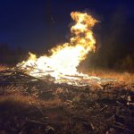
In mid-August, “exceptional” drought conditions — the most severe among the national drought monitor rankings — developed across nearly 7% of the state in northwest Colorado for the first time since May 2023. The exceptional rating hit portions of Moffat, Routt, Rio Blanco, Garfield, Eagle, Pitkin, Gunnison, Delta, and Mesa counties following one of the hottest, driest summers on record for the region.
“Fortunately, the exceptional drought that we had in early to mid-August is over in western Colorado with the persistent rains of the last few weeks,” said Russ Schumacher, Colorado’s state climatologist, at September’s Colorado Water Conditions Monitoring Committee meeting on Tuesday.
Comparing the Aug. 20 Colorado Drought Monitor to the most recent Sept. 16 map, Schumacher said, “you can see big improvements in a lot of places, but still long-term drought — severe to extreme drought — across much of western Colorado.”
During the last month, only portions of North Park, Grand County and the Denver metro area saw worsening drought conditions as they missed out on recent storms, Schumacher noted.
“It’s not that all the drought concerns are over in that part of the state, but it’s not these extreme conditions that we had a month ago, where wildfires were starting and growing every day and things like that,” Schumacher said. “Fortunately, that period is over for now. But then the flip side of that, we’ve seen flash flooding and debris flows, especially on the burn scars.”
-
Mid-August saw portions of northwest Colorado develop some of the worst drought the state has seen since May 2023.
U.S. Department of Agriculture/Courtesy Photo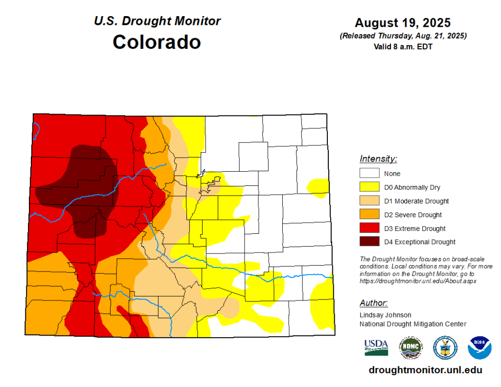
-
While extreme, long-term drought conditions persist in Western Colorado, recent rainfall has brought improvements.
U.S. Department of Agriculture/Courtesy Photo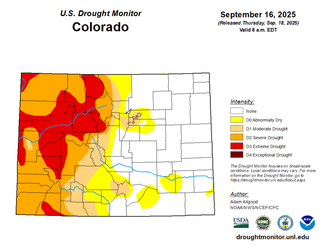
This switch is particularly evident in Meeker, where exceptional drought developed and the Lee Fire grew to one of the state’s largest in history in August. Meeker experienced its driest conditions in 30 years between June 15 to Aug. 21, Schumacher said.
“Since Aug. 21, they’ve had almost four inches of rain compared to an average of 1.71 (inches),” he added. “They had 1.2 inches of rain just yesterday (Monday, Sept. 22)… so just yesterday, they had more rain than in all of that period from mid-June through late August.”
Schumacher referred to this as a “pretty remarkable turnaround” from extreme conditions to wetter than normal. Now, however, portions of Meeker are dealing with heavy rain, flash floods and debris flows on the burn scars.
The effects of this recent rainfall in Western Colorado can also be seen in soil moisture levels.
“A month ago-ish, it was near or record dry soil moisture at that time,” Schumacher said of Western Colorado. “Now, it’s still dry in some places, but not nearly as dry. And other places have gone from extremely dry to the soils, the soil moisture being pretty well recharged from the recent rain … even in the deeper soil moisture, we’ve seen some recovery.”
August ranked among the top 10 hottest of the last 131 years on record for most of the Western Slope, marking the seventh month in a row that was warmer than normal across Colorado. The month also ended with near-normal precipitation for most of western Colorado, which Schumacher said only tells part of the story.
“It was very much not average in the way it played out,” Schumacher said. “It was three weeks of extreme dryness followed by one week of rain that brought the numbers back up to average.”
While much of this rain has brought precipitation for August up to near average numbers and helped reduce the most severe drought conditions, precipitation deficits remain and streamflow levels are still recovering.
A more uncertain Colorado winter forecast than usual
While rain — and even snow, in high elevation areas near the Continental Divide — are expected in parts of Colorado early this week, conditions are expected to dry back out, Schumacher said.
Western Colorado isn’t expected to see much precipitation over the next week, according to the seven-day forecast from the National Oceanic and Atmospheric Administration.
Looking further out at NOAA’s 8 to 14 day forecast, Schumacher said there is “high confidence of above-average temperature” into the first week of October.
“It’s fairly likely that the western slope will be below average precipitation over the next 15 days,” he added.
A warmer and drier than normal fall follows the predictions that La Nina conditions are expected to return from October to December in Colorado.
There is a “forecast consensus” that La Nina will return in the next few months, Schumacher said.
According to the Climate Prediction Center forecasts, Schumacher said it was likely — a 71% chance — that Colorado will “have La Nina in the fall, but it’s not going to last and it’s not going to be very strong.”
With summer officially over and fall in full swing, forecasters are also beginning to look ahead to winter and ski season. A La Nina summer typically favors better snow in Colorado’s northern mountains, but whether that is what happens is uncertain.
“The chances of La Nina persisting through the winter are maybe a coin flip,” Schumacher said. “That makes the winter outlook even more uncertain — it’s always uncertain and maybe even more uncertain than usual this year.”


Support Local Journalism
Support Local Journalism
As a Summit Daily News reader, you make our work possible.
Summit Daily is embarking on a multiyear project to digitize its archives going back to 1989 and make them available to the public in partnership with the Colorado Historic Newspapers Collection. The full project is expected to cost about $165,000. All donations made in 2023 will go directly toward this project.
Every contribution, no matter the size, will make a difference.