Update: Derby Fire now 2,625 acres, but growth has slowed
Community meeting will take place on Facebook Live Thursday evening
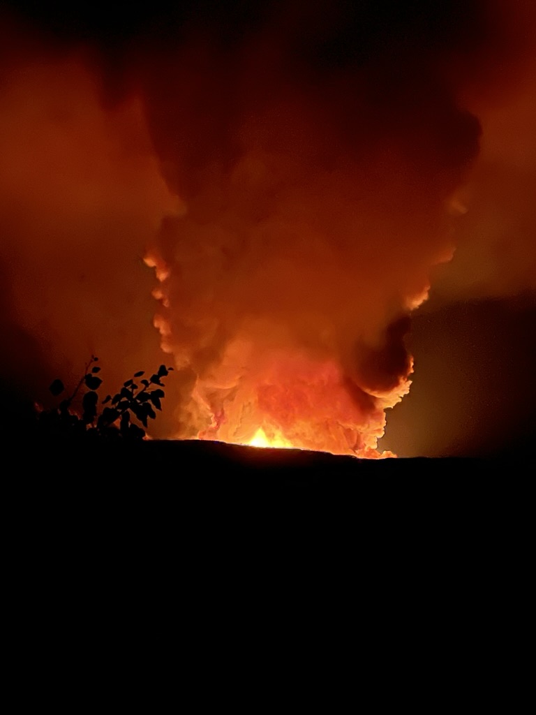
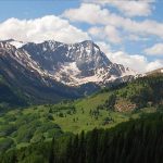
Derrick Wiemer/Courtesy photo
The Derby Fire burning in rugged terrain in the northwest corner of Eagle County is estimated at 2,625 acres and is 0% contained as of 9 a.m. Thursday.
While acreage has nearly doubled since the last reporting on Wednesday, the fire did not grow much in the last day, according to Public Information Officer Stefani Spencer. The new acreage is a more accurate measurement of the fire’s footprint thanks to an infrared flight on Wednesday night, she said.
Fire behavior has been wind-driven and growth was described as slow, according to Incident Commander Mike Behrens morning report.
The fire is mostly growing along its southern edge and crews expect to see slow, creeping growth on Thursday, Spencer said. Monsoonal moisture moving into the area could result in outflow winds that could increase fire activity.
“It’s sitting in a bowl, and things that were on fire would roll down and the fire would move up the hill and it just kept doing that,” Spencer said. “It got to the top of the plateau and it couldn’t do that anymore.”
While in the bowl near Derby Mesa, the fire was encountering mixed conifer fuels, which burned well. Now on top of the plateau, the fuel comprises more of aspen trees, which have been slowing the fire.
“It gives us more options for putting in containment lines,” Spencer said. “It’s a little more accessible and fire behavior is giving us some time to get some work done.”
A community meeting will take place via Facebook Live on the Derby Fire Facebook page Thursday at 6:30 p.m.
A lightning strike ignited the fire, which was first spotted on Sunday morning and has grown quickly over the last few days, prompting closures and evacuations.
As of Thursday morning, there are 117 personnel working on the fire, with five hand crews, nine engines and one helicopter on scene, according to the morning report, and Spencer said more resources are coming in daily. Ninety-three structures were reported as threatened, according to the National Interagency Fire Center.
The Northern Rockies Complex Incident Management Team 3 took over the fire early Wednesday.
Residents in the area of Sweetwater Road were ordered to evacuate by noon on Wednesday. The Two Rivers Community Center at 80 Lake Shore Drive in Dotsero is serving as evacuation center where displaced residents can receive information and resources.
The U.S. Forest Service and Bureau of Land Management have both issued closures in the fire area as well.
The Forest Service closure is within the Blanco and Eagle-Holy Cross Ranger Districts, starting north of Sweetwater Lake, following the Forest boundary north and east to the intersection of the Derby Loop Road (Eagle County Road 39); following Middle Derby Creek generally northwest to Island Lakes; then, generally south following the Island Lakes Trail (#1842), the W Mountain Trail (#1817), the Turret-Crescent Trail (#2269) and the Turret Creek Trail (#1838) back to Sweetwater Lake.
This closure affects BLM lands north and west of the town of Gypsum, Colorado, that are north of Coffee Pot Road; west of the Colorado River; east of the White River National Forest boundary; and south of Derby Creek.
This story is from VailDaily.com.


Support Local Journalism
Support Local Journalism
As a Summit Daily News reader, you make our work possible.
Summit Daily is embarking on a multiyear project to digitize its archives going back to 1989 and make them available to the public in partnership with the Colorado Historic Newspapers Collection. The full project is expected to cost about $165,000. All donations made in 2023 will go directly toward this project.
Every contribution, no matter the size, will make a difference.