Colorado considers earlier than normal activation of Drought Task Force as snowpack continues to lag behind
With record-breaking warmth and drier than normal conditions, the first four months of the 2026 water year have Colorado officials concerned

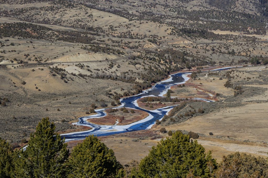
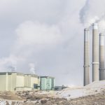
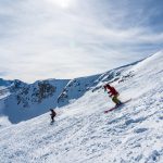
Chris Dillmann/Vail Daily
With one of the worst snowpacks on record and persistently warm temperatures, Colorado is weighing an early activation of its Drought Task Force.
The task force would pull together state agencies to monitor drought conditions, provide a coordinated response to agriculture, municipal water supplies, wildlife and recreation impacts, recommend emergency actions and declarations, facilitate allocation of resources and improve public communication.
“Usually, state action around drought response occurs in summer or the growing season, but because of the historically low snowpack and high temperatures, we are considering what Drought Task Force activation could look like earlier in the year,” said Emily Adrid, the Colorado Water Conditions Monitoring Committee water planning and climate impacts specialist.
The committee and its partner agencies — including the Colorado departments of natural resources, agriculture and local affairs, as well as the divisions of water resources and homeland security and emergency management — must request implementation of the task force from the Governor when conditions warrant it. Senior leaders from each of these Colorado agencies would comprise the task force.
According to Adrid, these partners have met internally to evaluate the next steps for an activation.
The task force is a key part of Colorado’s Drought Mitigation and Response Plan, which was most recently activated in June 2020 and maintained throughout the 2020-2021 drought. Before that, the state’s drought response and task force was fully activated in late April 2002 for the first time since the plan’s creation in 1981.
“The role of the (Drought Task Force) is to help better understand and elevate the local, regional or sector-specific impacts of drought,” Adrid said. “The (task force) has the ability to coordinate with the Governor’s Office, which may provide further assistance or seek additional federal support.”
Colorado sees continued trend toward record-breaking warmth, low snowpack
Data and information presented by the Colorado Climate Center and Natural Resource Conservation Service on climatological, snowpack, streamflow and water conditions at the monthly Water Conditions Monitoring Committee play a critical role in deciding when to activate. These organizations painted a bleak picture of current conditions at the latest meeting on Tuesday, Feb. 23.
Russ Schumacher, the Colorado state climatologist, reported that much of the state is already in drought conditions and experiencing a warm and dry winter — stacking on top of a long period of record-breaking warmth.
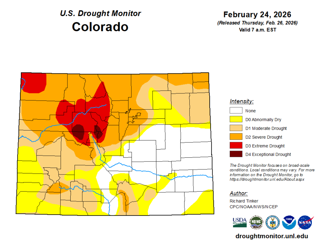
Looking at the national drought monitor, Schumacher said that Western Colorado has among the worst drought conditions in the country. The entire Western Slope is experiencing some degree of drought in the latest statewide monitor, including the 9% of the state that is experiencing extreme drought or worse. It is also where there are pockets of exceptional drought — the worst on the monitor — in Pitkin, Eagle, Summit, Lake and Park counties.
At this point in the season, drought conditions are largely informed by snowpack, according to Schumacher.
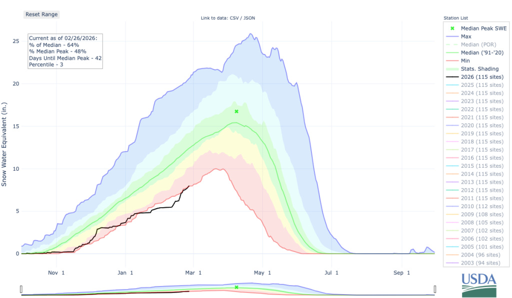
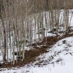
Despite the latest storms in February — which brought some degree of snowpack improvement to all Colorado basins — the statewide snowpack is still lagging behind at 64% of normal.
“The February storm cycle has reduced statewide (snow water equivalent) deficits but has not eliminated them,” said Nagam Bell, a hydrologist with the Natural Resources Conservation Service, adding that water year 2026, starting on Oct.1, currently ranks as the 45th out of the 46 years on record for snow water equivalent, which measures the amount of water in the snowpack.
These improvements were the highest in the southwestern mountain ranges, while the northern and central mountain region basins saw less improvement. The Colorado River headwaters and Yampa, White, Little Snake river basins are still experiencing historically low snowpack for the 41 years on record, sitting at 63% and 70% of normal, respectively, as of Feb. 25.
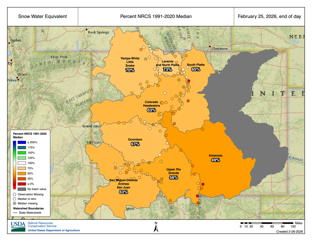
“Even with near normal conditions moving forward, reaching that median has historically not happened,” Bell said. “So we would need well above normal conditions to happen to reach that median.”
While dismal snowpack is part of the picture, it comes with a record-breaking warm start to the 2026 water year.
“January itself was not record warm, just a touch behind 1981, but all the time periods from three months to 24 months are the warmest on record for whatever that particular period is ending in January,” Schumacher said.
While October saw heavy rain and flooding in southwest Colorado, every month since has seen drier-than-normal conditions across the state, but particularly in the northwest.
“If we look back now over the last 12 months, or the last 360 days … you see this large area of Western Colorado from the central mountains up into the northern mountains, that is near record dry,” Schumacher said, noting that this area which includes portions of Summit, Eagle, Pitkin, Grand, Lake, Garfield, Routt, Rio Blanco counties “very, very, very dry over the last year.”
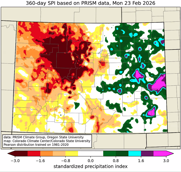
“These conditions in Western Colorado really stand out,” he said, adding that the end of the snow accumulation season was “quite dry,” followed by an “extremely dry” winter, a reprieve in the fall and “mostly dry” conditions since.
Schumacher said that climatologists don’t yet have a good answer for which climate dynamics are contributing to the warming trend this winter and beyond.
“La Nina winters tend to be warm and dry in the southwestern U.S., but they tend to be OK for our northern mountains and we obviously haven’t seen that, so I think that is a part of the story,” he said. “Climate change is part of the story. There’s probably more to it than that, though, and I think those will be interesting questions to try and sort out among the climate dynamics folks.”
While seasonal temperature, precipitation and drought forecasts for spring come with a lower degree of confidence and predictability, the outlooks are not favorable right now, Schumacher said.
“We might hope for a miracle March or some miracle this spring, but at least based on these outlooks, that’s not looking like what’s there,” he said. “It’s not a great sign when all the parts of the state that are not currently in drought are projected to be in drought by the end of spring. That aligns with that, the seasonal outlooks of warmer, tilted towards warmer and drier than average.”
Support Local Journalism
Support Local Journalism
As a Summit Daily News reader, you make our work possible.
Summit Daily is embarking on a multiyear project to digitize its archives going back to 1989 and make them available to the public in partnership with the Colorado Historic Newspapers Collection. The full project is expected to cost about $165,000. All donations made in 2023 will go directly toward this project.
Every contribution, no matter the size, will make a difference.