Colorado’s Western Slope to see storms, flash flooding — and some snow
Snow is expected to dust peaks as low as 12,000 feet starting this weekend
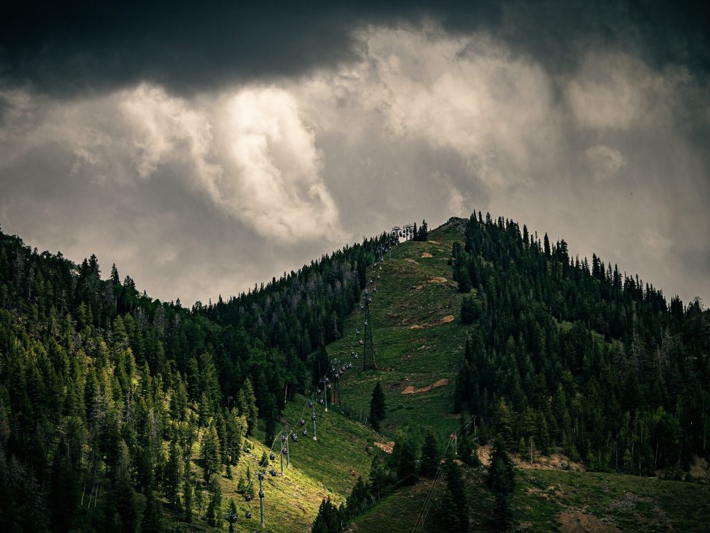
Austin Colbert/The Aspen Times
Monsoonal moisture is persisting in Colorado, with showers, weak storms and flash flood risk forecast for the Western Slope through Saturday. Drier and warmer conditions are expected to return by Sunday.
Most areas west of the Continental Divide are expected to receive 0.25-0.5 inches of rain from Wednesday, Sept. 16, through Friday, with more than 1 inch possible in isolated areas, according to a Wednesday report from OpenSnow.
Zach Hiris, a National Weather Service meteorologist at the Denver station, said the Mosquito Range bordering southern Summit County could end up with anywhere from a half-inch to 1.5 inches of rain by Saturday night.
Forecasts show a roughly 80% chance of precipitation across the High Country for all four days, with chances reaching up to 100% for Thursday in Rifle. Precipitation is expected to fall throughout the day, with morning, afternoon and evening showers in some mountain areas — contrary to the isolated afternoon showers seen toward the end of August.
“It’s very rare, especially out here on the Western Slope, that we’re even seeing greater than a 90% chance of rainfall out here, just because of how typically dry we are,” said Braeden Winters, a Grand Junction meteorologist with the National Weather Service. “But with us being in the monsoon season, we’re looking at very, very high-end moisture across the region, potentially record moisture [content in the atmosphere] for this time of year.”
In addition to lightning, forecasts show isolated risks for flash flooding. The Colorado Water Conservation Board has issued a low flood threat for parts of the Western Slope, including Garfield and Moffat counties, as of Wednesday morning.
“Flash flooding concerns … are going to be a little bit more isolated to locations that are vulnerable and that we know in the past have been (prone to) flash flooding, like the Redstone area, canyons along I-70 at times or recent burn scars,” Winters said. “But with how much rain we’ve seen recently, and how much rain we’re expecting to see over the coming days, we can’t rule out the potential for flash flooding in places that may not be as prone.”
Monsoon moisture could continue through Saturday, with drier and cooler air expected to move in by Sunday. Parts of the High Country could still see some light showers, but most areas are expected to stay dry.
Temperatures across the region are sitting at close to normal for this time of year, Winters said, ranging from highs in the mid-60s in Vail to the mid-70s in Aspen.
“These temperatures are expected to persist for quite a while at this point,” he said.
Light snow in the forecast for some mountain peaks
Winters said the Grand Junction National Weather Office hasn’t seen any significant snow potential in the forecast for the Western Slope as of Sept. 16, though trace amounts of snow could materialize on the highest peaks on Saturday.
While early season snow has been dusting Colorado’s 14ers, Hiris said lower elevations around 12,000 feet could start to see precipitation fall as snow starting this weekend — though it’s still too warm for it to stick.
“Even though we are starting to cool down, we’re still not necessarily hitting those temperatures needed for any sort of notable snow,” Winters said.
Colorado’s Western Slope to see storms, flash flooding — and some snow
Monsoonal moisture is persisting in Colorado, with showers, weak storms and flash flood risk forecast for the Western Slope through Saturday.








Support Local Journalism
Support Local Journalism
As a Summit Daily News reader, you make our work possible.
Summit Daily is embarking on a multiyear project to digitize its archives going back to 1989 and make them available to the public in partnership with the Colorado Historic Newspapers Collection. The full project is expected to cost about $165,000. All donations made in 2023 will go directly toward this project.
Every contribution, no matter the size, will make a difference.