Will it snow this weekend in Colorado’s mountains? Forecasts show a possibility after warm spell.

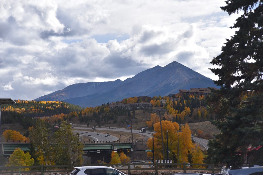
Kit Geary/Summit Daily News
Some warmer weather over the next few days is likely to bend the trend of cooler weather being here to stay.
The first snow of the year typically causes elk to migrate to lower elevation areas, and it sparks conversations about what local ski resort will open first for the season. The Breckenridge Open Space and Trails Department has already reported spotting elk moving down to lower elevation areas on their wildlife cameras, and the race between Arapahoe Basin Ski Area, Keystone Ski Resort and Loveland Ski Area to be the first resort to open in the Summit County area has begun since all plan to open as soon as possible.
National Weather Service forecaster Bruno Rodriguez said areas near Summit will be under the influence of a high pressure system Thursday, Oct. 2, and Friday, Oct. 3, that could bring summer-like temperatures. Thursday could bring a high of 71 degrees with a forecast indicating clear skies. Some clouds are expected to roll in Friday, but the high is still forecast to be near 70 degrees. High-Alpine areas could reach 50 degrees during this time.
Thus far, only Copper Mountain has announced that it has fired up its snow guns, but the temperatures for Thursday and Friday are not overly conducive to snowmaking.
According to meteorologist-founded app OpenSnow, mountains in Summit County like Arapahoe Basin typically need a 26 degree “wet bulb” temperature. A “wet bulb” temperature takes into the account the actual temperature and the percentage of humidity in the air. Current OpenSnow forecasts indicate most mountains in Summit County won’t see daytime temperatures around or below 30 degrees until Monday.
In terms of precipitation bringing snow to Summit’s peaks over the weekend, Rodriguez said that looks a bit up in the air. National Weather Service forecasts for Breckenridge call for a mix of rain and snow overnight on Saturday and Sunday, but the chance for precipitation is at 20% and could change as those dates get closer.
“We do have a system on track for the weekend with a little bit of uncertainty with it,” Rodriguez said. “For the most part it’s favoring more of a northerly track, and Summit County is kind of on the southern edge of the area getting probably the bulk of the precipitation.”
According to OpenSnow, the only resort near Summit with a chance of snow is Beaver Creek in Eagle County.
He said current models show Saturday having the best chance for precipitation. Sunday also has a slight chance of precipitation, but the model is not showing anything too significant, Rodriguez said. Temperatures will likely drop 10-15 degrees, and he said some areas above tree line could reach freezing temperatures.
Anyone planning a hike this weekend might want to think about bringing a windbreaker. Winds could reach up to 40 miles per hour in higher terrain, Rodriguez said. Lower terrain areas could see winds around 20 miles per hour.
While it could change, current weather models show a small chance of showers Monday and Tuesday.


Support Local Journalism
Support Local Journalism
As a Summit Daily News reader, you make our work possible.
Summit Daily is embarking on a multiyear project to digitize its archives going back to 1989 and make them available to the public in partnership with the Colorado Historic Newspapers Collection. The full project is expected to cost about $165,000. All donations made in 2023 will go directly toward this project.
Every contribution, no matter the size, will make a difference.