As the West is facing an upcoming ‘heat dome,’ Summit County’s weekend looks dry

Eliza Noe Follow

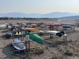
Eiliana Wright/Summit Daily archive
Summit County weekend forecasts show higher temperatures than seen previously this summer, and it could be a result of a larger shift toward hot weather across the West.
Looking at the overall region, some meteorologists are expecting temperatures to rise across the intermountain west heading into this weekend. Monsoon conditions should continue through the middle of the week, but shifting weather patterns could put a damper on thunderstorm development by Friday.
Accuweather released a report warning of a “heat dome” expected to build across the West and High Plains. In these conditions, there’s a northward shift in the jet stream and air sinks, temperatures climb and precipitation and cloud cover are generally limited.
“The (monsoonal) pattern that set up this year actually allowed the monsoon to start a little earlier than what we saw last year,” AccuWeather chief broadcast meteorologist Bernie Rayno said. “The pattern I’m talking about is that big upper-level high that usually waits until July to form, actually formed in June.”
According to the National Weather Service in Boulder, precipitation chances will drop to 10% by Thursday night, whereas midweek chances remain higher at 30% to 70% depending on the day. As the weekend approaches, Summit County highs will remain in the low 80s and mostly sunny.
“Bottom line, heat for this weekend is becoming more likely. Get ready,” Caitlyn Mensch, meteorologist at the National Weather Service in Boulder, said in the long-term weather discussion. “Conditions will also remain fairly dry with this pattern. Model guidance shows a general consensus in weakening of the ridge pattern by the end of the weekend bringing slightly cooler temperatures and an increase in moisture for the start of next week.”
In the short term, precipitation in the mountains could be between 0.6-0.9 inches as deep moisture moves over New Mexico and rotates north into Colorado. While other parts of the state may see higher precipitation or thunderstorms, any prerequisites for severe weather are expected to be “marginal” at higher elevations. Over the next 14 days, temperature and precipitation probabilities remain above average, according to the National Weather Service’s Climate Prediction Center.
Denver Water is reporting that Dillon Reservoir is currently 96% full and water elevation is at 9,017 feet at the spillway. As of early June, the Blue River is now considered at base flow, or the flows that Summit County ends up with through the fall and winter one snowpack melts. On Tuesday, Tenmile Creek measured 140 cubic feet per second and the Blue River under Dillon Reservoir measured 55.7 cubic feet per second.
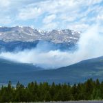
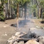
Monsoon conditions continue to keep Summit County’s fire restrictions at bay. Over the past couple of weeks, fire officials have deemed the county live fuel moistures, which are the moisture levels within a plant that has the potential to be burned in a wildfire, below average. Earlier this year, state officials expected that wildfire risk would hit a peak in Summit County in June, but early predictions were unclear whether or not the Western Slope would have substantial rains.
Support Local Journalism
Support Local Journalism
As a Summit Daily News reader, you make our work possible.
Summit Daily is embarking on a multiyear project to digitize its archives going back to 1989 and make them available to the public in partnership with the Colorado Historic Newspapers Collection. The full project is expected to cost about $165,000. All donations made in 2023 will go directly toward this project.
Every contribution, no matter the size, will make a difference.