Forecasters say thunderstorms are on their way to Summit County to kick off an early monsoon season


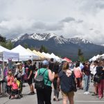
Brian Benjamin/Courtesy photo
Forecasters say Summit County residents will start to see signs of monsoon season approaching this week with scattered rain and thunderstorms throughout the week.
National Weather Service forecaster Bruno Rodriguez said a low-pressure system moving in from the southwest is on its way to Summit County, and the area is expected to “hang on to chances of daily thunderstorms each afternoon through the week” starting midday Monday.
“It’s been trending a little bit drier over the past 24 to 48 hours. So what was looking like a widespread heavy rain is starting to look more like a widespread moderate rainfall,” he said.
He said thunderstorms could pick up by the afternoon and result in up to half an inch of rain for most areas of Summit County. Temperatures will be around the low 70s before they are expected to drop to low-to-mid 60s on Tuesday. Storms are anticipated to dry up a bit Tuesday before picking back up Wednesday.

Rodriguez said there’s a strong chance of afternoon thunderstorms Wednesday, Thursday and Friday afternoons. Temperatures are expected to stay around the 60s throughout this time. Mild wind reaching up to 7 mph is expected to accompany the afternoon thunderstorms. Chances for weekend thunderstorms are currently low, he said.
He said forecasts out of the Climate Prediction Center are showing an early monsoon season starting off in June.
“As far as the near term, we are favoring a wetter than normal pattern for this month of June, but we do foresee a little bit of a drying trend as we progress through the summer,” he said.
A recent report from the meteorologist-founded weather app OpenSnow predicts monsoon season to be “fairly active” in the first portion of summer.
Rodriguez said forecasts show the drying will begin around mid-July and continue into August.
Long-range forecasts from the National Oceanic and Atmospheric Administration show 40% to 50% chances for below-average precipitation this summer, andna 70% to 80% chance for temperatures to be higher than historic levels.
A recently released summer outlook from the Farmers Almanac says people should gear up for a hot summer and predicts the region including Colorado will experience “scorching” heat.
“Heat will be in full force by July, with much of the nation sweltering with above- to high-above average temperatures,” the Farmers Almanac report states. “More long-time high temperature records may be broken this year.”
A drought monitor report lists Summit County as being “abnormally dry” as of May 27. In terms of its surrounding counties to the west, western portions of Eagle and Routt are listed as being in “severe drought.” Counties to the east like Clear Creek and Boulder are listed as not experiencing drought conditions.


Support Local Journalism
Support Local Journalism
As a Summit Daily News reader, you make our work possible.
Summit Daily is embarking on a multiyear project to digitize its archives going back to 1989 and make them available to the public in partnership with the Colorado Historic Newspapers Collection. The full project is expected to cost about $165,000. All donations made in 2023 will go directly toward this project.
Every contribution, no matter the size, will make a difference.